
The Digital transformation of Ecological Monitoring (DEM) project is developing new ways to monitor the North Sea ecosystem more accurately, sustainably, and efficiently. Using tools such as smart measurement buoys and artificial intelligence (AI), the project aims to map ecological changes with greater precision. Now that the Spanish company Adasa Sistemas has won the tender to develop the measurement buoys, the largest sub‑project within DEM, a new phase of the project is starting.
Insight into changes and the use of the North Sea
The client for DEM is Jeroen Vis, programme manager for Nature Enhancement at the North Sea at the Ministry of Agriculture, Fisheries, Food Security and Nature. He explains that the North Sea is undergoing major changes in energy, food, and fisheries.
“We do not yet fully understand what these changes mean for the North Sea ecosystem and how we use it. For example: what will the new wind turbines mean for marine life, water temperature, and salt distribution? Existing research and monitoring programmes do not always provide the insights needed to understand how the North Sea functions or to make policy decisions about its spatial planning. New technologies can help deepen and broaden the knowledge we have. DEM enables an acceleration in the development of new methods and technologies.”
Gaining new knowledge with buoys
Project manager Arthur de Waard from Rijkswaterstaat calls it “a very exciting project.”
“There is a lot involved before durable, functioning measurement buoys can be deployed at sea. They must, for example, be able to withstand winter conditions and storms. With their technical expertise, the Spanish team is helping us develop robust buoys that will enable new knowledge about the North Sea. Once the buoys are ready, we will conduct measurements for two years. The resulting data will be prepared and transferred. After that, users such as scientists can derive new insights from it.”
Three new sensors
The buoys will be equipped with sensors that perform measurements. Scientific expert Anouk Blauw from Deltares explains more.
“There are three relatively new sensors that can take measurements. With the combination of sensors collecting data simultaneously, we will learn more about currents, algal species composition, and primary production [the growth of algae and other microscopic plants]. These data do need to be processed and standardised—meaning they must be quality‑checked and prepared for international data portals.”
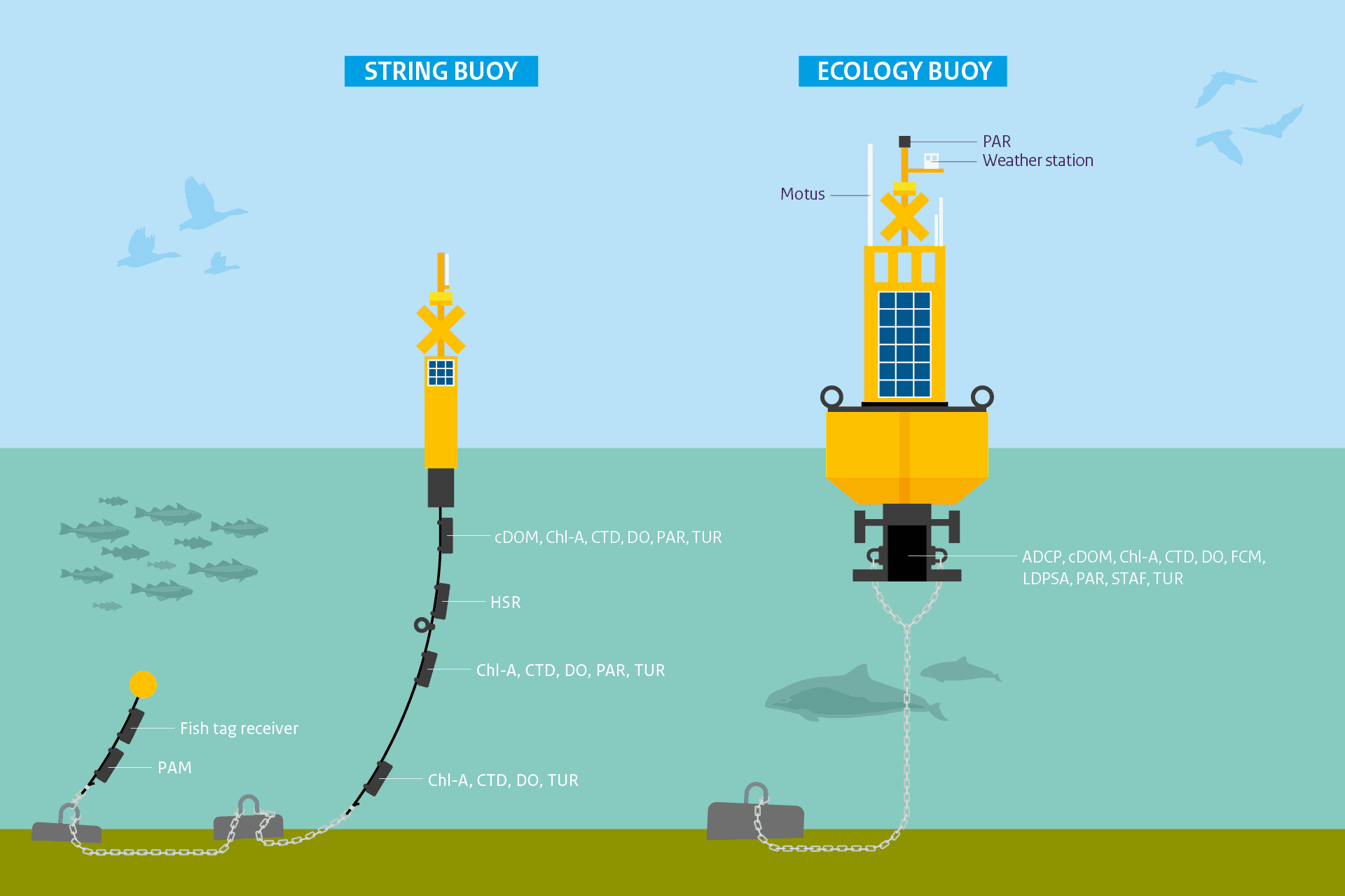
ADCP: Acoustic Doppler Current Profiler. cDOM: colored Dissolved Organic Matter. Chl-A: Chlorofyl A. CTD: Conductivity Temperature Depth. DO: Dissolved Oxygen. FCM: Flow Cytometry. Fish tag receiver for the European Tracking Network. HSR: HyperSpectral Radiometer. LDPSA: Laser Diffraction Particle Size Analyzer. Motus Wildlife Tracking System. PAM: Passive Acoustic Monitor hydrophone. PAR: Photosynthetically Active Radiation. STAF: Single Turnover Active Fluorometry. TUR: Turbidity.
Making data available
One important reason for post‑processing is that data must be comparable with measurement results from existing monitoring programmes.
“Measurements from different methods don’t directly align. Since the 1970s, the Monitoring Waterstaatkundige Toestand des Lands (MWTL) programme has taken water samples in various locations in the North Sea. These measurements are legally required to determine water quality and track changes over time. They are intended to evaluate existing policies, but this programme is insufficient to answer new questions about the effects of offshore wind farms. With the buoys we can take multiple measurements per hour, whereas current measurements are only taken once or twice a month. But because the buoys use different measurement methods, post‑processing is needed to make new and old data comparable.”
From needs to product
The development of new measurement methods begins with the knowledge needs of researchers and policy programmes. Therefore, Arthur de Waard consults with these “need owners.”
“They tell me what information and data they need to fulfil their project assignments. For example, researchers want to learn more about the ecology of the North Sea but don’t know what technical tools are required, because this is a relatively new field. Then I say: this is what we can offer with these sensors—is that what you're looking for? That creates an interaction in which we work step by step toward a shared solution.”
Ecological effects on seabirds and marine mammals
One of these need owners is the Offshore Wind Ecological Programme (Wozep). Programme manager Ingeborg van Splunder from Rijkswaterstaat explains how ecological research connects to offshore wind development.
“Before constructing a wind farm, expected ecological effects must be assessed based on existing knowledge. The long‑term Wozep research programme was established to understand the effects of offshore wind on seabirds and marine mammals. For example, Wozep investigates where different bird species fly—do they avoid wind farm areas or not?”
Recognising and counting species at high speed
Van Splunder describes how DEM supports this research.
“Knowledge institutes are training an AI model that can recognise and count species at lightning speed. DEM purchases flights equipped with high‑definition cameras that can capture sharp images from high altitude. The model analyses the images and determines the number and types of animals. This helps us learn more about the distribution of guillemots, other bird species, harbour porpoises, and seals.”
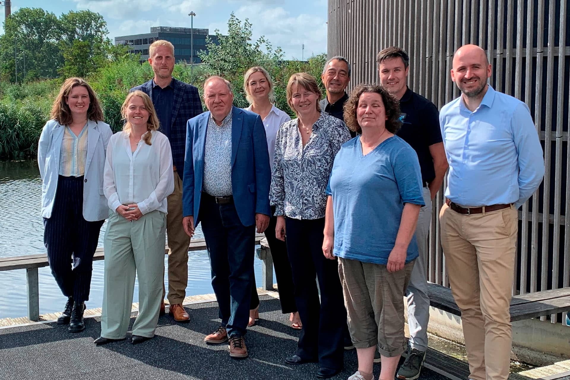
From left to right: Mainah Folkers (RWS), Laura Dinkla (RWS/Aqitec), Ivo Wieling (RWS/Aqitec), Kees Borst (RWS), Sarah Rautenbach (Deltares), Anouk Blauw (Deltares), Arthur de Waard (RWS), Nicole Dijkman (RWS), Joris Diehl (RWS), Erik Hendriks (Deltares). Present online: Jef Huisman (UvA) and Dick van Oevelen (NIOZ).
Why DEM matters
With technological innovation and close collaboration, DEM is laying a strong foundation for future ecological monitoring. But what do Vis, De Waard, Van Splunder, and Blauw personally value about the project?
“What we are building here is very visible,” says De Waard. “It gives us better insight into the ecology of the North Sea and human impact.”
For Van Splunder, the value lies in connecting research and policy: “Reliable research helps the government make good decisions about developments in the North Sea.”
Vis sees DEM as successful “if the project establishes a cheaper, new way of monitoring—and if data users find what they are looking for.”
Blauw views it through a scientific lens: “It’s wonderful that we will finally get measurement data to answer new questions, improve our understanding of the North Sea, and better support policy.”
Their perspectives differ, but all point in the same direction: better insight into a rapidly changing North Sea and a stronger basis for policy. DEM links technology, science, and policy, ensuring that data are better aligned and usable. In doing so, the project takes an important step forward in how we collect and apply ecological information.
More about this topic
DEM is a project of the Information Provision at Sea (IV op Zee) programme at Rijkswaterstaat. The project runs from 2024 through 2028 and is carried out by the Central Information Services (CIV) of Rijkswaterstaat (RWS). DEM aims to innovate and digitise ecological monitoring in the North Sea. To safeguard the ecological capacity of the North Sea, insight into its changing ecosystem is essential. More information about DEM can be found here.